What Are GPS and Chartplotters?
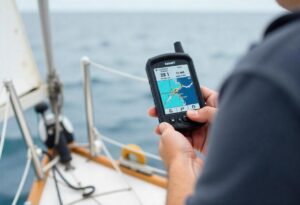
GPS (Global Positioning System): A GPS device determines your precise location using satellite signals. It provides coordinates that can be used to track your position on a map.
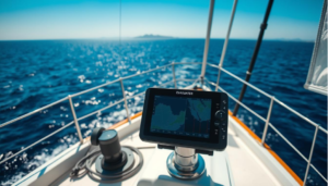
Chartplotter: A chartplotter combines GPS functionality with electronic nautical charts, offering a visual representation of your position on detailed maps. It helps in route planning, monitoring, and integrates with other navigation tools.
Why You Need GPS and Chartplotters
- Accuracy: Both tools provide precise location data, essential for avoiding navigational hazards like, shallow waters, rocks and reefs, buoys and marks, etc.
- Route Planning: They allow you to plot courses, set waypoints, and adjust your route as needed.
- Real-Time Data: These devices offer up-to-date information on your position and surrounding environment, enhancing safety and efficiency.
- Integration: Many chartplotters integrate with other systems like radar and sonar for a comprehensive navigational experience.
Top GPS and Chartplotters for Coastal Navigation
1. Garmin GPSMAP 8610XSV
The Garmin GPSMAP 8610XSV stands out for its sharp, high-resolution display and precise chart and sonar imaging. This model It’s designed for accuracy, helping you track your location precisely and seamless integration with Garmin’s BlueChart g3 charts. It is particularly noted for its detailed charting and connectivity with other Garmin devices for a comprehensive navigation experience.
Key Features
- 10-inch high-resolution display
- Built-in Wi-Fi and Bluetooth
- Compatibility with Garmin’s extensive chart library
Pros
- Exceptional Display Clarity and Detail: The 10-inch high-resolution screen ensures sharp and detailed charts and sonar images, making it easier to navigate and interpret data.
- Easy Integration with Other Garmin Systems: Seamlessly connects with Garmin radar, autopilots, and sonar, enhancing situational awareness by overlaying additional data on your charts.
- User-Friendly Interface: The intuitive touchscreen allows quick access to features and settings, simplifying navigation and route planning.
Cons
- Higher Price Point: Its premium features come with a higher price, which may be a consideration for those on a tighter budget.
- Satellite Signal Dependence in Remote Areas: Relies on satellite signals, which can be problematic in remote areas with limited visibility, potentially affecting navigation accuracy.
2. Raymarine Axiom+ 9
The Raymarine Axiom+ 9 provides bright, high-resolution touchscreen and advanced processing power, which deliver smooth, responsive navigation experiences. It excels with its intuitive interface and integrated features like built-in sonar and radar, which enhance safety and fishing opportunities. Its user-customizable interface allows you to streamline your navigation setup to fit your personal preferences.
Key Features
- 9-inch touchscreen display
- Built-in sonar and radar integration
- Fast quad-core processor
Pros
- Excellent visibility and responsiveness: The 9-inch high-resolution touchscreen ensures clear visibility and quick response, making navigation easier in all lighting conditions.
- Advanced sonar and radar capabilities: Built-in sonar and radar offer detailed underwater and weather data, enhancing safety and improving fishing opportunities.
- Customizable user interface: You can personalize the interface to quickly access the features you use most, streamlining your navigation experience.
Cons
- Can be expensive: The high cost may be a barrier for those on a budget or those needing only basic features.
- Requires updates and maintenance: Regular software updates and maintenance are necessary to keep the device running smoothly, which can be a hassle.
3. Lowrance HDS-9 LIVE
The Lowrance HDS-9 LIVE is renowned for its high-definition sonar imaging, which provides detailed views of underwater structures and fish. Its large, clear display ensures that all this information is easy to read and interpret, even in bright sunlight. It’s especially advantageous for detailed coastal navigation due to its advanced imaging capabilities and high-resolution screen. Additionally, the HDS-9 LIVE integrates well with other marine electronics, allowing for a more cohesive and comprehensive navigation system.
Key Features
- 9-inch high-definition display
- LiveSight real-time sonar imaging
- Advanced mapping and navigation tools
Pros
- Detailed sonar and imaging capabilities: LiveSight sonar provides clear, real-time underwater imaging for precise navigation and fishing.
- Large, easy-to-read display: The 9-inch high-definition screen makes it easy to view and interpret detailed charts and data.
- Comprehensive navigation features: Advanced mapping and navigation tools offer extensive functionality for coastal navigation.
Cons
- Price may be high for some budgets: The cost might be a concern for those seeking more affordable options.
- May require learning curve for new users: Its advanced features might take time to master for those new to marine electronics.
4. Simrad GO9 XSE
The Simrad GO9 XSE offers an appealing mix of affordability and practical functionality. It features a high-resolution display that delivers crisp, clear visuals of your navigation charts and sonar data. The interface is designed to be intuitive and user-friendly, which simplifies operation and enhances overall usability, making it a solid choice for both beginners and experienced sailors. Despite its lower price point, the GO9 XSE provides reliable performance for coastal navigation, offering essential features and dependable accuracy without compromising on quality.
Key Features
- 9-inch touchscreen display
- Integrated GPS and sonar
- Simple, intuitive interface
Pros
- Good balance of features and price: Offers a mix of essential features and affordability, making it accessible for many users.
- Easy to use and set up: The intuitive interface simplifies navigation and setup, ideal for both new and experienced users.
- Reliable GPS and sonar performance: Provides dependable navigation and sonar data, ensuring accurate and safe sailing.
Cons
- Fewer advanced features compared to higher-end models: Lacks some high-end functionalities found in more expensive units.
- May require additional accessories for full functionality: Some features might need extra accessories, potentially increasing the overall cost.
5. Garmin GPSMAP 1243xsv
The Garmin GPSMAP 1243xsv stands out for its large, high-resolution screen and built-in sonar capabilities. It’s perfect for sailors who need detailed charts and real-time data for coastal navigation.
The Garmin GPSMAP 1243xsv stands out for its large, high-resolution screen, which provides a vivid and detailed view of your charts and sonar readings. Its built-in sonar capabilities deliver real-time data. The GPSMAP 1243xsv is designed for those who require precise and detailed navigation tools, with advanced features that support accurate chart plotting and real-time situational awareness. Its large display and powerful sonar integration make it particularly well-suited for sailors who need comprehensive and reliable navigation data.
Key Features
- 12-inch high-resolution display
- Built-in sonar and CHIRP technology
- Compatible with Garmin’s BlueChart g3 charts
Pros
- Large display for easy navigation: The 12-inch screen offers a broad, clear view of charts and data, enhancing navigation ease.
- Advanced sonar features: Built-in sonar and CHIRP technology deliver detailed and accurate underwater information.
- Seamless integration with other Garmin products: Works well with Garmin’s ecosystem, providing a cohesive navigation experience.
Cons
- Premium price: Its higher cost might be a drawback for those seeking budget-friendly options.
- Requires regular chart updates: Keeping charts current involves ongoing updates, which can be an extra expense and effort.
Choosing the Right GPS and Chartplotter
When selecting a GPS or chartplotter for coastal navigation, consider the following factors:
- Screen Size and Resolution: Larger, high-resolution screens provide better visibility and detail.
- Integration: Ensure compatibility with other systems like radar and sonar.
- Ease of Use: Look for devices with intuitive interfaces and user-friendly controls.
- Budget: Balance your needs with the cost of the device.
Garmin GPSMAP 8610XSV or Garmin GPSMAP 1243xsv
The Garmin GPSMAP 8610XSV and Garmin GPSMAP 1243xsv are both high-performance marine chartplotters, but they cater to slightly different needs with distinct features.
When it comes to outfitting your vessel with the right chartplotter, the Garmin GPSMAP 8610XSV and Garmin GPSMAP 1243xsv both stand out as top contenders. But how do they stack up against each other for sailors like you? Let’s dive into the key differences to help you choose the best fit for your needs.
Display Size & Clarity
- Garmin GPSMAP 8610XSV: Features a 10-inch high-resolution display. It’s clear and detailed, but if you prefer an even larger screen for those long-distance views, you might find the next option more appealing.
- Garmin GPSMAP 1243xsv: Boasts a 12-inch high-resolution display. The extra screen real estate can make a big difference when navigating complex coastal routes or monitoring multiple data streams at once.
Sonar Capabilities
- Garmin GPSMAP 8610XSV: Comes with advanced sonar technologies like ClearVü and SideVü. This means you get crystal-clear images of what’s beneath and beside your boat – perfect for spotting underwater structures and fish schools with unparalleled detail.
- Garmin GPSMAP 1243xsv: Equipped with solid sonar and CHIRP technology. It provides good underwater imaging but might not capture the same level of detail as the 8610XSV. It’s still plenty capable for most navigation and fishing needs.
Connectivity & Integration
- Garmin GPSMAP 8610XSV: Offers top-notch connectivity with Garmin’s Marine Network and supports the ActiveCaptain app. This allows for seamless integration with other Garmin devices and gives you access to charts and information right from your smartphone or tablet.
- Garmin GPSMAP 1243xsv: Works well with Garmin’s BlueChart g3 charts, ensuring you have access to detailed, up-to-date navigation data. However, it might lack some of the more advanced connectivity options found in the 8610XSV.
Price & User Experience
- Garmin GPSMAP 8610XSV: Comes with a higher price tag due to its advanced features and extensive connectivity options. It’s a fantastic choice if you want the latest technology and are willing to invest in a premium setup.
- Garmin GPSMAP 1243xsv: More budget-friendly and offers a simpler, more straightforward user experience. If you’re looking for a solid chartplotter that covers all the essentials without breaking the bank, this model is a great choice.
In essence, the Garmin GPSMAP 8610XSV is ideal for sailors who demand cutting-edge sonar technology and superior integration with Garmin’s ecosystem. On the other hand, the Garmin GPSMAP 1243xsv provides excellent performance and a larger display at a more accessible price, making it a strong contender for those who want reliable functionality without the premium price.
Choosing between these two models comes down to your specific needs and budget. Whether you’re after advanced features or a great value, both chartplotters will enhance your sailing experience with Garmin’s trusted technology.
Conclusion
Investing in a high-quality GPS or chartplotter is essential for safe and effective coastal navigation. The tools listed here offer a range of features and capabilities to suit different needs and budgets. By choosing the right device, you’ll enhance your navigation experience and ensure a smoother, more enjoyable voyage.
